Automatic Packet Reporting System (APRS) is an amateur radio-based system for real-time digital communications of information for a local area developed by Bob Bruninga WB4APR. Utilizing AX.25 packets, data can include object GPS coordinates, weather station telemetry, text messages, announcements, queries, and other telemetry. APRS data can be displayed on a map, which can show stations, objects, tracks of moving objects, weather stations, search and rescue data, and direction finding data.
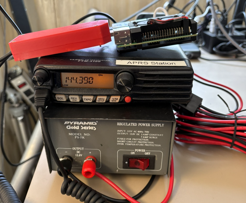
APRS data is typically transmitted on a single shared frequency (depending on country) to be repeated locally by area relay stations (digipeaters) for widespread local consumption. In the United States, 144.390 MHz is the frequency used. All packets are typically passed into the APRS Internet System (APRS-IS) via an IGate receiver and distributed globally. Data shared via radio or Internet are collected by all users and can be combined with external map data to build a shared live view. APRS.fi is a great implementation of this mapping using Google Maps and an overlay. Our page is embedded below.
The Skunkworks team has setup a Raspberry Pi 3B+ running Direwolf software TNC feeding to/from a Yeasu FTM-3100 transceiver. We are a Digipeater, IGate, and also broadcast our Weather Station’s telemetry.
The local APRS stations as well as W2MMD-13 can be seen at the aprs.fi web page.
The APRS station received weather data from the Acu-Rite weather station mounted on one of the Clubhouse towers. The weather station transmits weather data on the 433 MHz unlicensed frequencies, which is picked up by an RTL-SDR connected to a Raspberry Pi computer running the rtl_433 software. That program loads the data into an MQTT server that’s then queried by a Node Red script that extracts the relevant metrics and formats them into the proper format for the beacon text of Direwolf. Direwolf them transmits that data on the 144.390 APRS frequency and also transfers it thru an IGATE gateway to the APRS network.
 Save as PDF