GOES-16 is a Geostationary Operational Environmental Satellite (GOES) series operated by NASA and the National Oceanic and Atmospheric Administration (NOAA) and is the weather satellite in the East, located at 75.2° W, which provides a view centered on the Americas. GOES-16 provides high spatial and temporal resolution imagery of the Earth through 16 spectral bands, at visible and infrared wavelengths, using its Advanced Baseline Imager (ABI). GOES-16’s Geostationary Lightning Mapper (GLM) is the first operational lightning mapper flown in geostationary orbit. The payload also includes: Extreme Ultraviolet and X-ray Irradiance Sensors (EXIS), Solar Ultraviolet Imager (SUVI), Magnetometer (MAG), and Space Environment In-Situ Suite (SEISS).
At the clubhouse, the Skunkworks team has built a receiver using a Raspberry Pi and a low cost NooElec SDR to receive photos and telemetry on 1.691 GHz. In addition GOES 16 will occasionally relay images from the GOES17 satellite located over the Pacific Ocean. For more information please check out our blog post here.
Much guidance on the image processing was provided by the usradioguy.com website and the posts in the Geostationary Weather Satellite Group Facebook group managed by Carl Reinemann along with some personal help from Carl. Check out his site if you’re interested in this kind of stuff. Many thanks, Carl – we couldn’t have done it without you.
Below you can find links to our most recently received photos and telemetry from the clubhouse. The data is received continually from GOES16 and is processed every four hours (the processing itself takes about three hours). It’s uploaded to the website within the hour after its processing is complete.

This video was created from ten days of individual FD CH13 infrared images sent by GOES16. Each image is enhanced using the extraordinary Sanchez program that underlays the colored images of the earth and water. Those images are then processed by a script that adds the filename and Skunkworks logo to each image. The process then uses Imagemagick to create a GIF video which is then further processed with ffmpeg to smooth the transmission between individual frames.
Click here to view the high resolution video.
Click here to view the high resolution photo.

This video is from images taken by GOES 17 over the Pacific Ocean and relayed by GOES 16. It’s processed as described above.
Click here to view the high resolution video.
Click here to view the high resolution photo.
This image is built from two separate grayscale images, one from GOES16 and one from GOES17. The Sanchez program merges the two images selecting those with the closest timestamps. It then underlays the land and sea coloring and flattens the image. The result is a beautiful high-resolution view of half of the planet.
Click here to view the high resolution image.
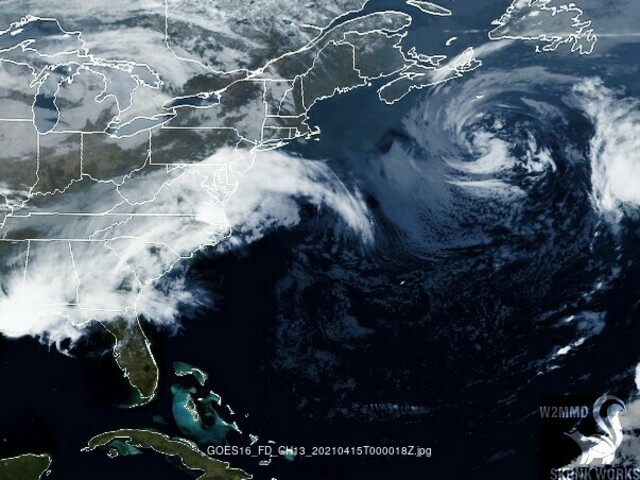
This video is created from the GOES16 full-earth view and trimmed using the Sanchez program down to the eastern US. It’s then processed into video as described above.
Click here to view the high resolution video.
Band 9 – Mid-level water vapor – IR
Click here to view the high resolution video.
Click here to view the high resolution photo.
Band 15 – Longwave Window – IR
Click here to view the high resolution video.
Click here to view the high resolution photo.
Sea skin temperature
Click here to view the high resolution video.
Click here to view the high resolution photo.
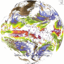
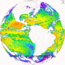
Total water precipitation
Click here to view the high resolution video.
Click here to view the high resolution photo.
 Save as PDF