Skip to content
Gloucester County Amateur Radio Club

Gloucester County Amateur Radio Club

Skunkworks Advanced Project Team

Menu
  • Home
  • Clubhouse
    • The GCARC Clubhouse
    • Grounding Project
    • Networking Infrastructure
    • Work and Test Bench
    • Earth-Moon-Earth (EME) Operations on 1296 MHz
    • Discovery Dish: Remote L-Band Weather Satellite Reception
    • Clubhouse Remote SDR Resource: nRSP-ST
    • SatNOGS Ground Station at W2MMD
    • W2MMD Skunkworks GitHub Resource
    • Satellites
      • Imagery
        • GOES Weather Satellite
        • ISS SSTV
        • NOAA Weather Fax
      • Telemetry and Operating
        • W2MMD Satellite Station
        • SatNOGS
        • Fox in a Box Telemetry Receiver
        • Othernet Satellite Receiver
    • Tracking
      • ADS-B
      • AIS Ship Position Tracking
  • Technical Activities and Resources
    • 3D Printed Projects
    • DMR
      • Using DM-1701 CPS Program
      • Open GD77 on Baofeng DM1701
    • Software-Defined Radios
      • Software Defined Radio Demystified
    • Meshtastic
      • Getting Started with Meshtastic on 915 MHz: A Comprehensive Guide
    • BTECH UV-PRO Dual-Band Handheld Radio
      • Satellite Mode for the UV-PRO
    • TIDRADIO H3 Resources
      • TIDRADIO TD-H3 Transceiver: Comprehensive Briefing
      • Overview of Stock Firmware Menu System
      • Comparison of Stock TIDRADIO Firmware vs. nicFW V2 Firmware
    • Balloon Project
      • Balloon Launch – 2025-03-17
    • Tech Saturday Presentations
  • STEM Club and Camp
  • Public Service
    • Winlink VHF and HF Gateways
    • APRS Weather Reporting Station
    • AREDN Development
  • The Foundation
  • Blog
  • Contact

SatNOGS Ground Station at W2MMD

The Gloucester County Amateur Radio Club proudly operates a SatNOGS (Satellite Networked Open Ground Station) receiver as part of the global Libre Space Foundation network. SatNOGS is an open-source, crowdsourced system that enables distributed ground stations to automatically track and receive telemetry, data, and signals from hundreds of amateur radio satellites orbiting Earth.

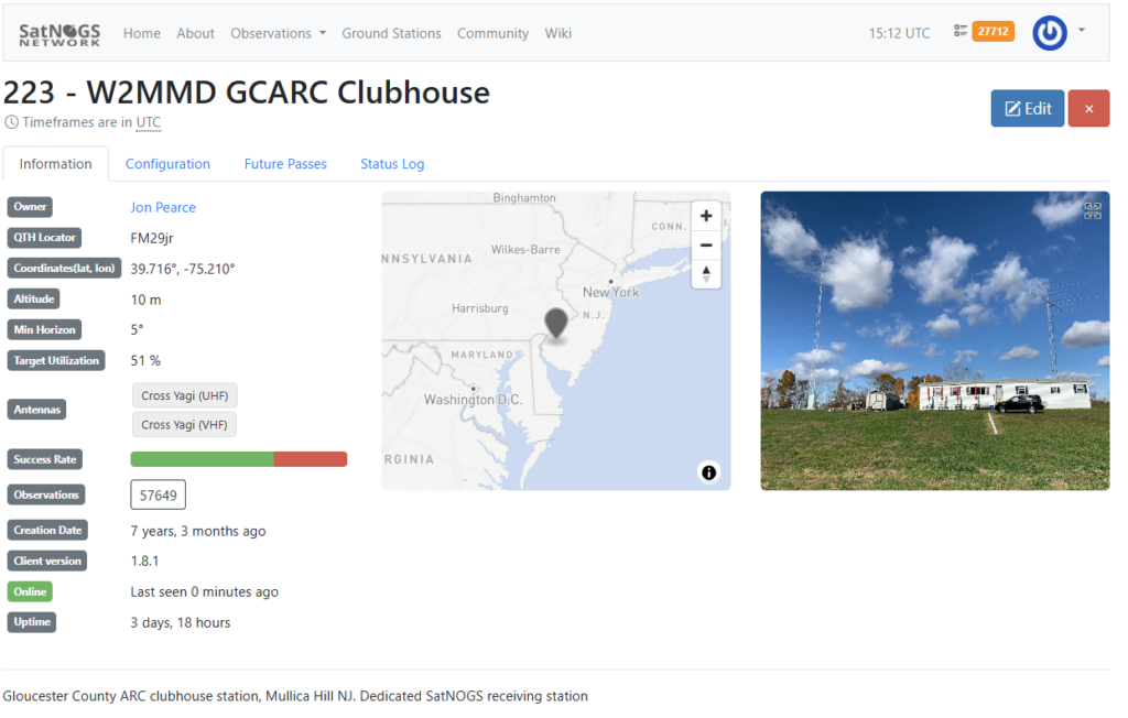
Our station, known as W2MMD GCARC Clubhouse (Station 223), is integrated with the club’s high-performance satellite antenna array: a 22-element cross-Yagi on 2 meters (144 MHz) and a 42-element cross-Yagi on 70 cm (432 MHz), mounted on an azimuth-elevation rotator. This setup provides exceptional gain and sensitivity—far superior to many other East Coast stations—allowing reliable reception of weak signals from low-Earth-orbit satellites.

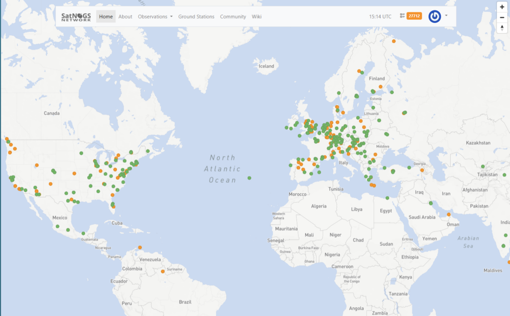
Thanks to these powerful antennas, our station consistently achieves high-quality observations, making it a popular choice on the SatNOGS network. Users worldwide schedule passes on Station 223 to capture telemetry from a wide variety of satellites, including CubeSats, educational payloads, and weather/imaging birds that transmit on amateur frequencies.

Contribution to Satellite Science

By participating in SatNOGS, GCARC directly supports the global amateur satellite community and space research:

  • Collecting and publicly archiving telemetry data for satellite operators, universities, and organizations to monitor spacecraft health, orbits, and experiments
  • Enabling decoding of scientific payloads, such as environmental sensors, radiation measurements, or technology demonstrations
  • Providing reliable data during launch campaigns and for long-term orbit tracking
  • Promoting open-source collaboration and education in space communications

View our station’s status, past observations, and schedule future passes at the official page: SatNOGS Station 223 – W2MMD GCARC Clubhouse.

This resource exemplifies GCARC’s commitment to advanced VHF/UHF operations and citizen science in space!

Archives

  • July 2024
  • November 2023
  • April 2023
  • March 2023
  • June 2022
  • July 2021
  • April 2021
  • March 2021
  • September 2020
  • September 2019
  • August 2019
  • July 2019
  • June 2019
  • December 2018
  • November 2018
  • October 2018
  • September 2018
  • August 2018
  • July 2018
  • June 2018
  • May 2018
  • April 2018

Categories

  • Balloon
  • Clubhouse Infrastructure
  • Digital Position Tracking
  • Raspberry Pi
  • Satellite Images
  • Satellite Operations
  • Satellite Telemetry
  • SDR
  • Uncategorized

Meta

  • Log in
  • Entries feed
  • Comments feed
  • WordPress.org
  • Home
  • Clubhouse
    • The GCARC Clubhouse
    • Grounding Project
    • Networking Infrastructure
    • Work and Test Bench
    • Earth-Moon-Earth (EME) Operations on 1296 MHz
    • Discovery Dish: Remote L-Band Weather Satellite Reception
    • Clubhouse Remote SDR Resource: nRSP-ST
    • SatNOGS Ground Station at W2MMD
    • W2MMD Skunkworks GitHub Resource
    • Satellites
      • Imagery
        • GOES Weather Satellite
        • ISS SSTV
        • NOAA Weather Fax
      • Telemetry and Operating
        • W2MMD Satellite Station
        • SatNOGS
        • Fox in a Box Telemetry Receiver
        • Othernet Satellite Receiver
    • Tracking
      • ADS-B
      • AIS Ship Position Tracking
  • Technical Activities and Resources
    • 3D Printed Projects
    • DMR
      • Using DM-1701 CPS Program
      • Open GD77 on Baofeng DM1701
    • Software-Defined Radios
      • Software Defined Radio Demystified
    • Meshtastic
      • Getting Started with Meshtastic on 915 MHz: A Comprehensive Guide
    • BTECH UV-PRO Dual-Band Handheld Radio
      • Satellite Mode for the UV-PRO
    • TIDRADIO H3 Resources
      • TIDRADIO TD-H3 Transceiver: Comprehensive Briefing
      • Overview of Stock Firmware Menu System
      • Comparison of Stock TIDRADIO Firmware vs. nicFW V2 Firmware
    • Balloon Project
      • Balloon Launch – 2025-03-17
    • Tech Saturday Presentations
  • STEM Club and Camp
  • Public Service
    • Winlink VHF and HF Gateways
    • APRS Weather Reporting Station
    • AREDN Development
  • The Foundation
  • Blog
  • Contact

Gloucester County Amateur Radio Club 2025 . Powered by WordPress